
GFTS transforms how we protect our oceans and manage fisheries by streamlining the analysis and visualization of fish biologging data.
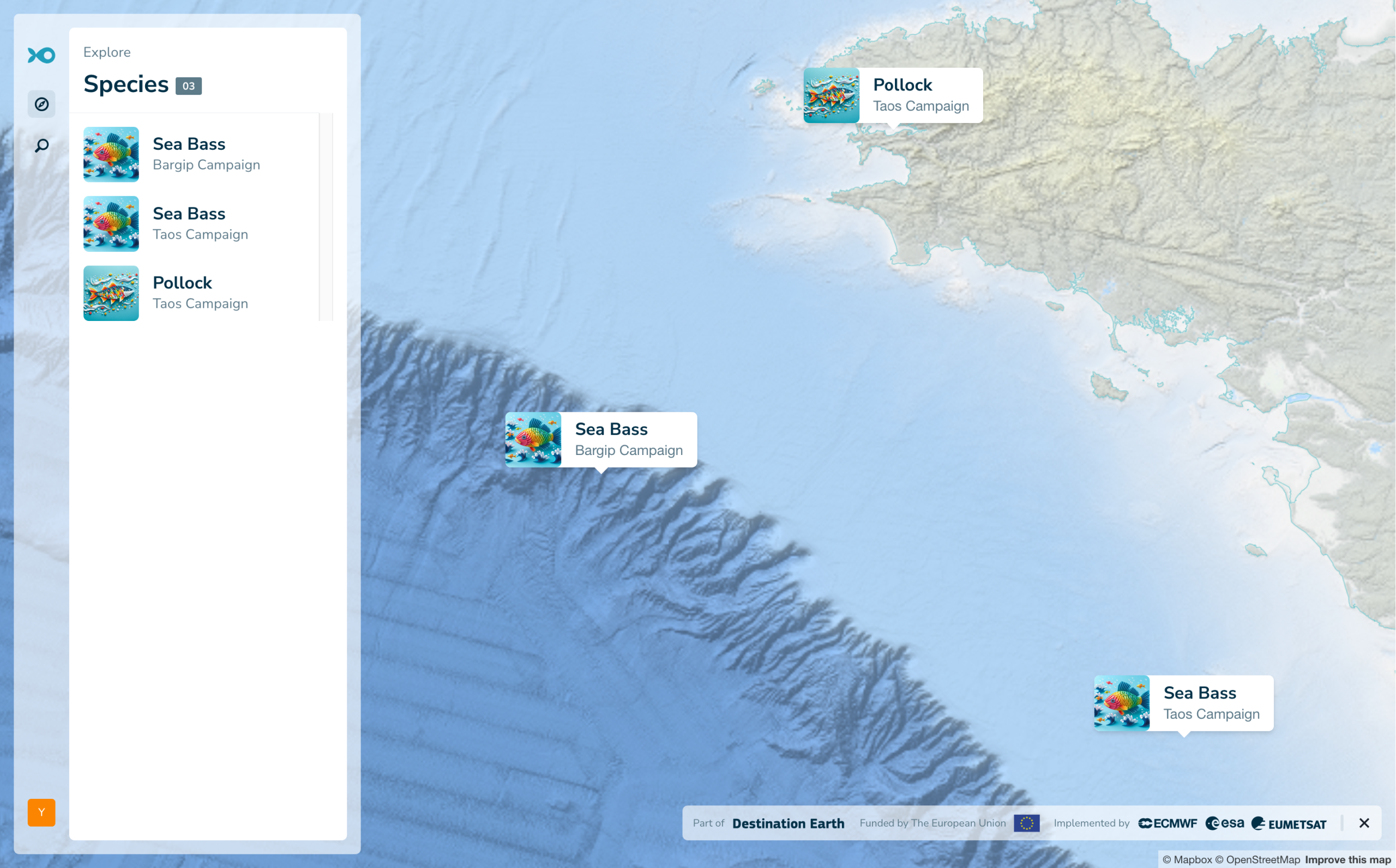
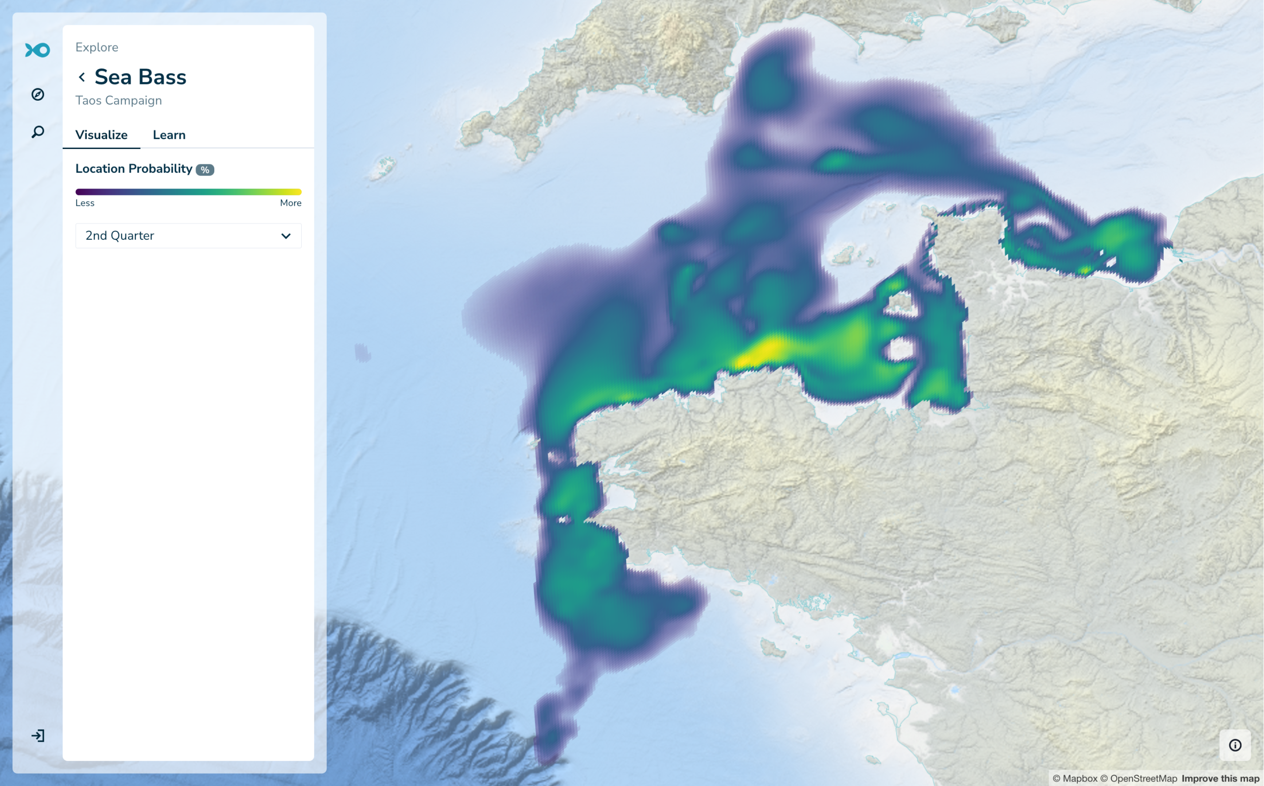
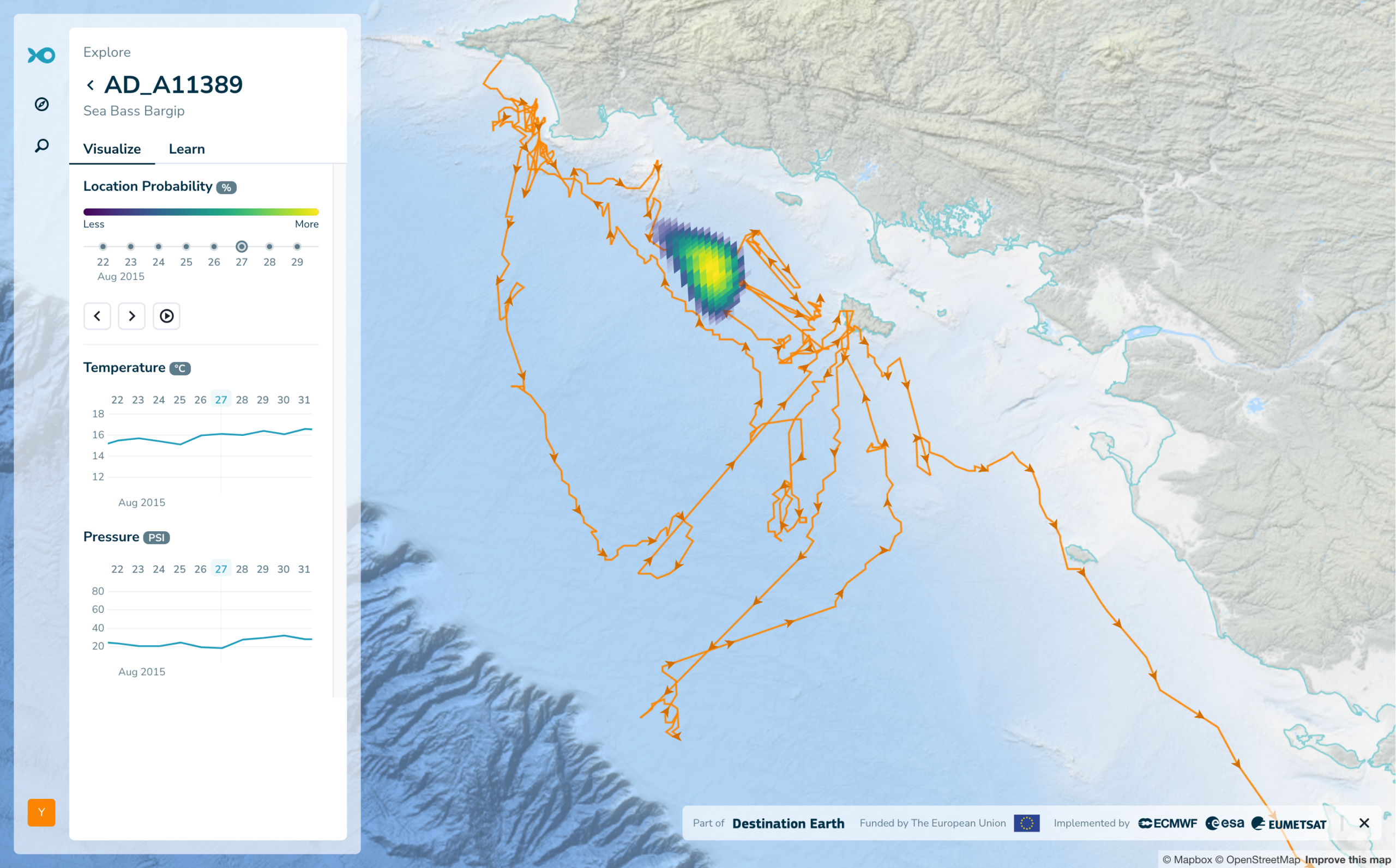
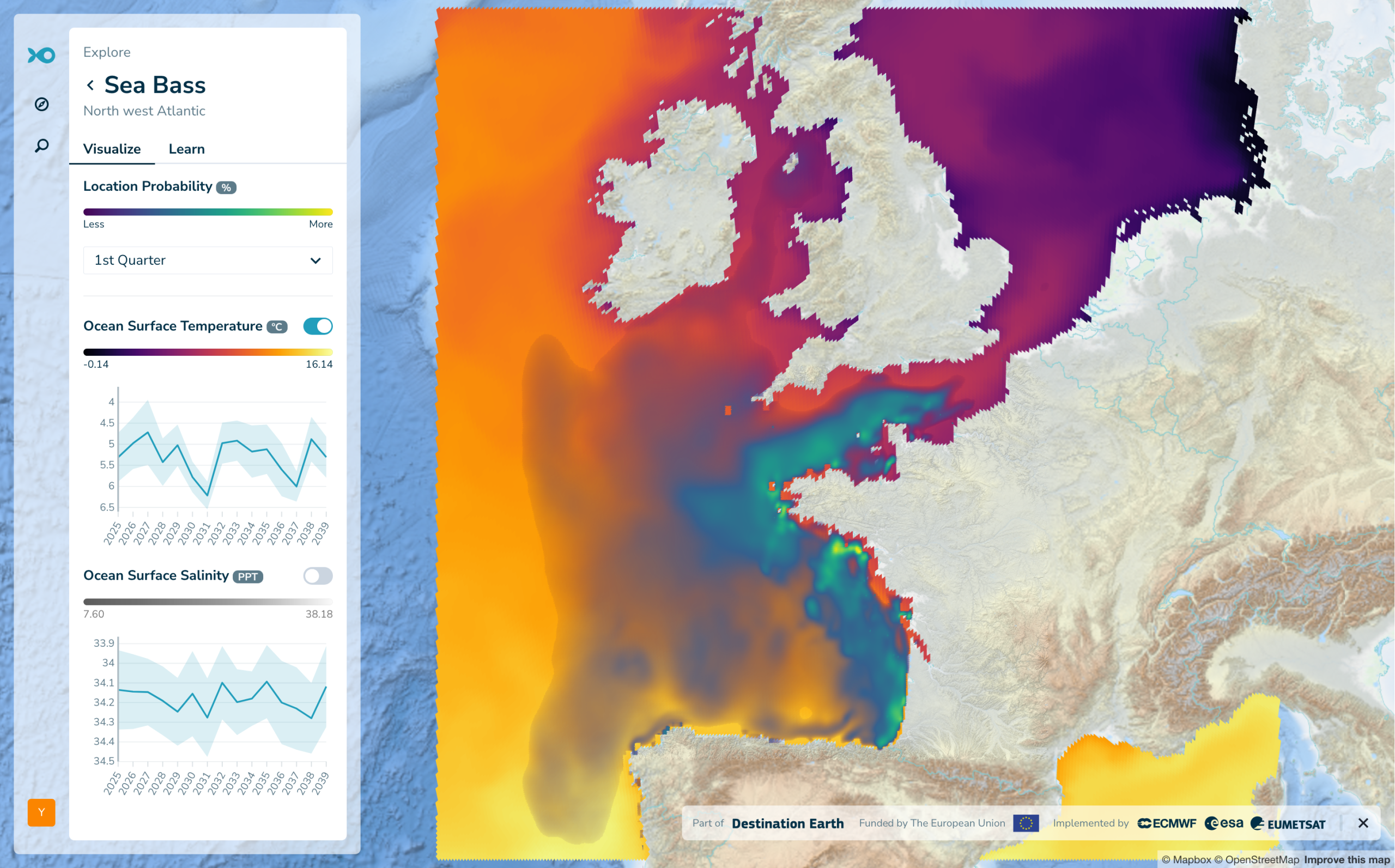
Scientists using GFTS can convert raw biologging data into fish tracks in a scalable environment. Individual tracks and group level habitat maps can be created and seamlessly integrated in the GFTS visualisation tool.
Future ocean conditions in these habitats are computed based the DestinE Climate Adaptation Digital Twin.
Policy makers can visualize critical fish habitats and migration patterns with a new level of clarity.
This enables evidence-based decisions on marine protected areas and sustainable fishing quotas without requiring technical expertise.
If you are a scientist with biologging data, get in touch with our team to help you get onboarded.