AQWALYTICS documentation
Welcome to AQWALYTICS !
AQWALYTICS is an advanced service for monitoring the quality of water bodies at high resolution developed by Magellium and vorteX-io.
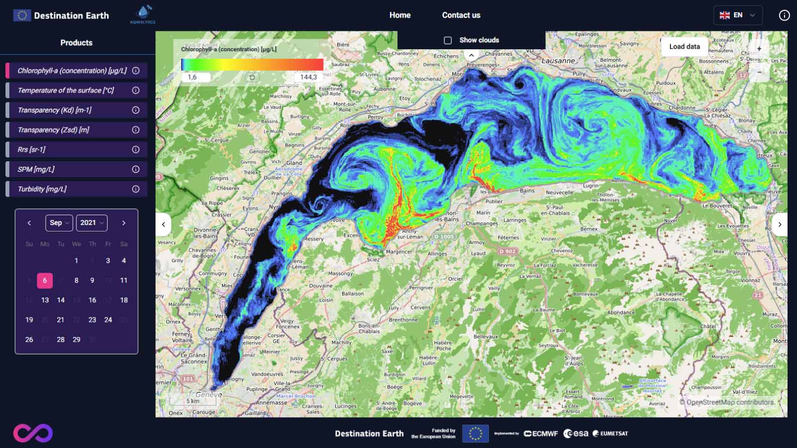
It relies on an innovative combination of large-scale satellite observations and high-frequency in-situ data. This system ensures precise, continuous, and tailored monitoring of key parameters such as water surface temperature, transparency, turbidity, and chlorophyll-a concentration for public and private stakeholders. The service aims at providing a tangible response to address today’s critical water challenges, from resource scarcity and rising temperatures to declining quality, and protecting biodiversity, human health, and economic vitality. The service offers a territorial approach to focus on local needs and provide advanced analytics which will support suitable decision-making.
AQWALYTICS plateform
The standard service available in the DestinE platform enables users to access data to a wide coverage of water bodies through Europe as illustrated in the map below. For the service launch, 24 water bodies have been identified and are made accessible. They cover lakes, estuaries, lagoons and rivers from 17 different countries. Additional water bodies may be added to the standard service.
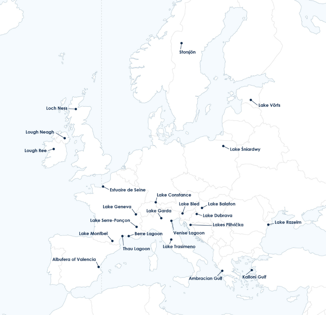
Water bodies included in the demonstration version
Contact
Should you want to share with us your experience, to learn more about AQWALYTICS or to ask for more locations and/or advanced features, please contact us at aqwalytics-contact@magellium.fr .
For further assistance, reach out to AQWALYTICS support through the platform’s contact option.