The High-Resolution Land Surface Temperature (Hi-Res LST) service provides high-resolution 30m land surface thermal information using advanced machine learning. The service is based on data fusion technique applied to the coarser Sentinel-3 with 1km spatial resolution, using the 30m land surface temperature product from Landsat-8.
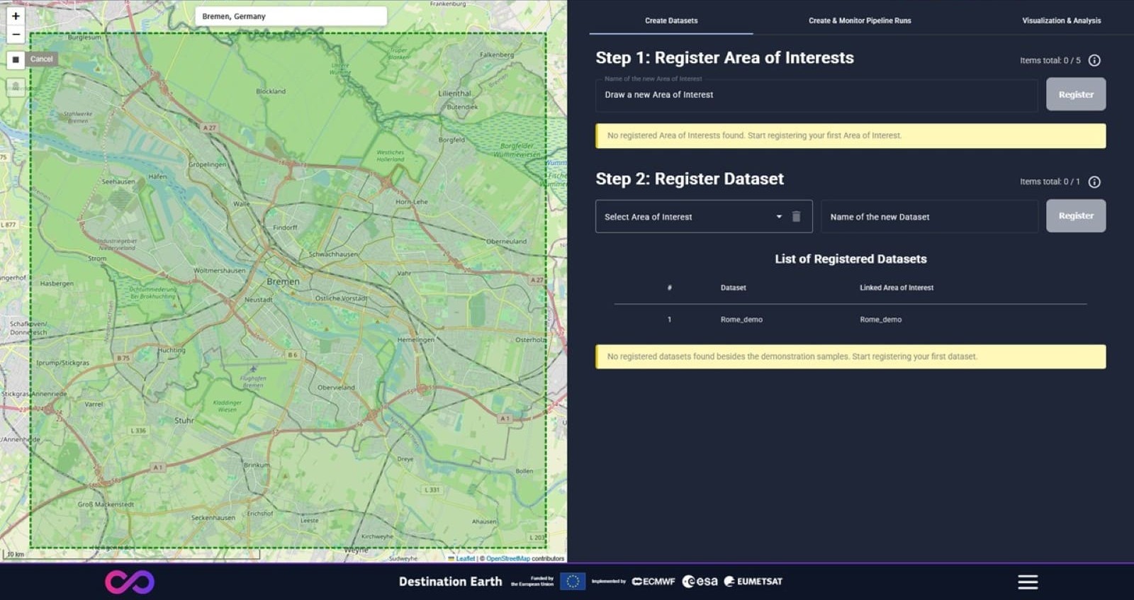
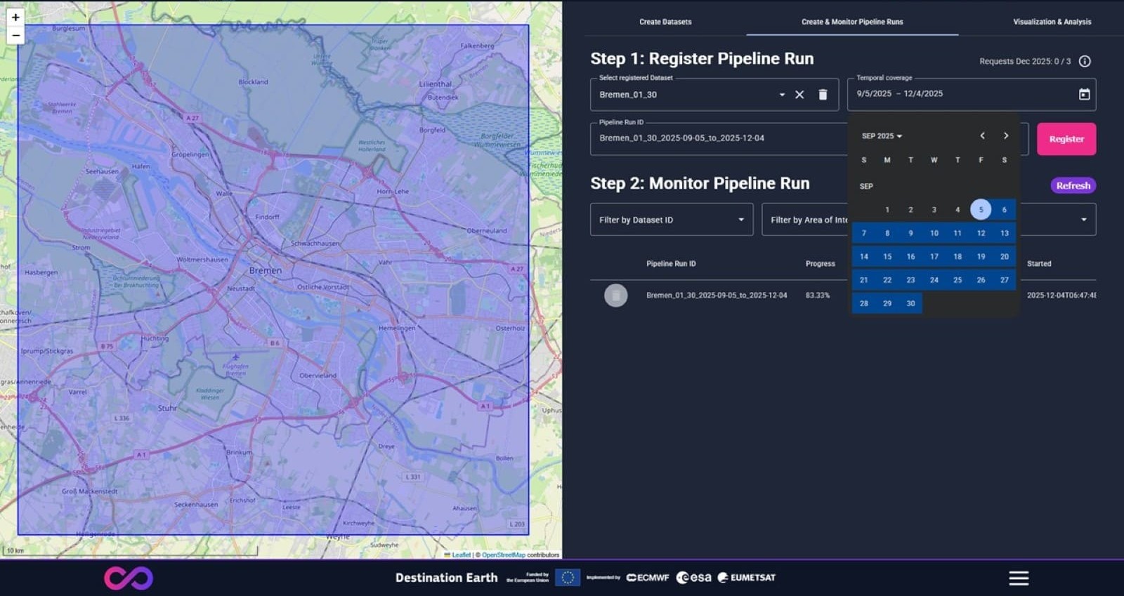
Besides visualization and analysis of land surface temperature layers and time series for user-defined locations, the service offers as key features creation of new areas of interests, datasets, and monitoring of user-triggered pipeline runs that provide the service results.
Intended use for enhanced land surface temperature estimation as needed by end-users in different applications where high resolution LST is of importance, such as urban resilience, infrastructure monitoring applications.