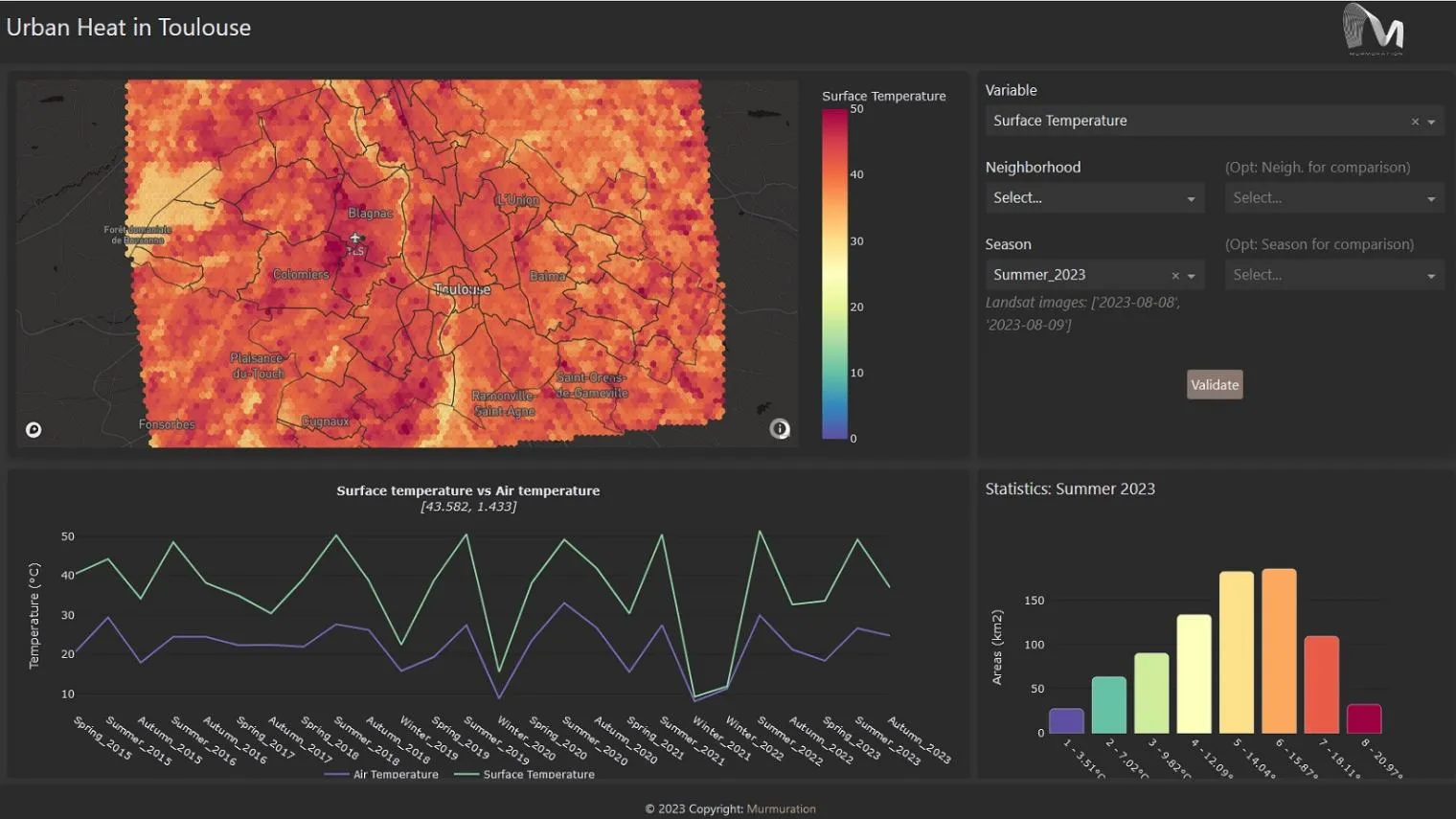
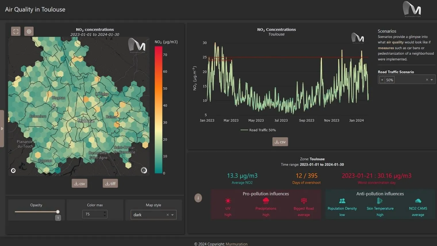
The Urban Square project aims to provide tools to analyse and anticipate environmental threats in urban areas: air quality, fluvial flood, sea level rise, urban heat, infrastructure damages and impact on resources. Urban Square provides demonstrational applications that illustrate the service capabilities, with datasets covering the cities of Toulouse (France) and Valencia (Spain) for the period from 2015 to 2024.