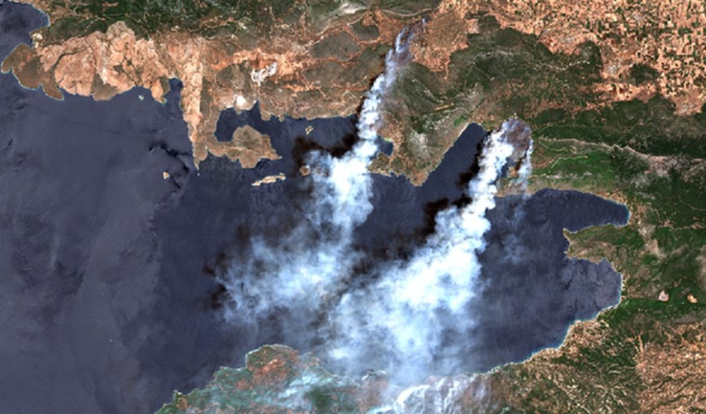
The DEA service, implemented by partner Alia Space, has released a new interactive story titled Europe’s 2026 Wildfires from Space – A Copernicus Multi-Mission Approach, exploring how satellite observations provide complementary perspectives on wildfire events.
In the final weeks of July 2026, wildfires spread across several parts of Europe. Within a few days, Spain, Portugal, France and Greece requested emergency mapping support.
The story shows how different instruments across the Copernicus Sentinel constellation contribute distinct capabilities to wildfire monitoring:
- Sentinel-3 SLSTR offers frequent, wide-area observations that reveal active thermal anomalies and their evolution over time.
- Sentinel-3 OLCI provides the broader daytime context, including smoke transport and surrounding landscape features.
- Sentinel-2 MSI provides much finer spatial detail, with a resolution as fine as 10 m, allowing fire fronts, burn scars, and affected areas to be resolved.
Together, under cloud-free conditions, these observations provide a more complete view of how individual wildfire events develop over time.
- Explore the story interactively on DEA
- Watch the video on YouTube
- Visit the DEA service here