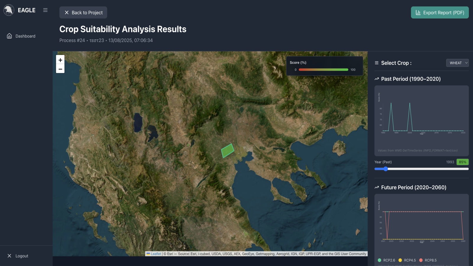
The EAGLE platform is a Geospatial AI service designed with a responsive, user-friendly interface to facilitate Earth Observation (EO) data processing and analysis. It enables users to upload EO datasets, leverage pre-trained AI models, and create new object detection workflows within an intuitive, no-code environment. The system supports annotation through an integrated tool offering various annotation types and class-based tagging. It streamlines the entire process, from project setup and data annotation to model configuration and running inferences, all within a unified interface. EAGLE also supports model training tasks on user-preprocessed data, ensuring transparency and reproducibility throughout the model lifecycle. Future capabilities include advanced AI methods, integration of additional EO data sources via federated STAC APIs, real-time data processing, and enhanced user collaboration.