Global land deformation monitoring.

About the service

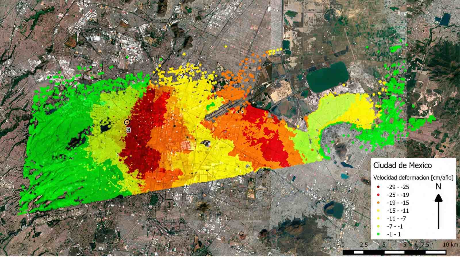
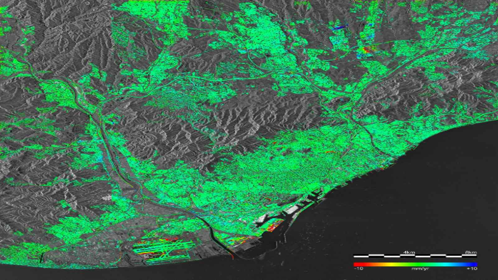
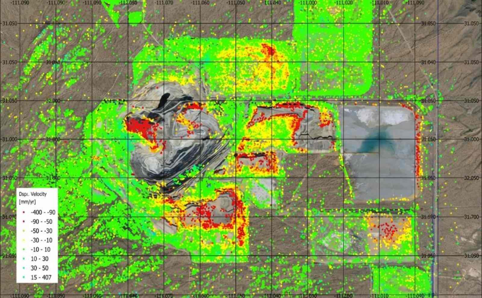
GGMS (Global Ground Motion Service) is a global, on-demand, platformed-based deformations monitoring service. The service produces a cloud of georeferenced points, each characterised by the deformation velocity and deformation time series.

ADA (Active Deformation Area) map service allows an easy-to-use screening of the results of any InSAR analysis. It identifies the clusters of points that show deformation.

DDM (Differential Deformation Map) service presents spatial differential deformations or spatial deformation gradients. This information is derived for any building or infrastructure of a significant size located in a given area of interest.

Service details

Operated by:

FUNDED by: 

STATUS:

Beta Testing

version:

1.0.0

Thematic Areas

Cross-sectorial services
Policy Making & Decision Support
Risk & Resilience
Urban, Transports & Tourism

Gallery

Resources

This video tutorial walks through the GGMS workflow, from defining the area of interest to interpreting the results.

Similar Services

You are about to leave the DestinE platform website

By proceeding, you might be redirected to the website of a third party, which will act as an independent data controller with respect to the personal data collected through its own website, as described in its relevant privacy notice.

Please note that:

Serco Italia S.p.A. remains the data controller of the personal data collected within the scope of the DestinE Platform, including where such data are collected through external platforms; such data will be processed in accordance with Serco Italia SpA’s Privacy Policy, which was made available to you prior to the collection of the personal data.

For further information on the processing of personal data carried out by Serco Italia S.p.A.  within the scope of DestinE platform, please consult the Privacy Policy